
Nationwide elevated highways in the works to boost mobility, minimise land use
- Update Time : Sunday, May 18, 2025
Staff Correspondent:
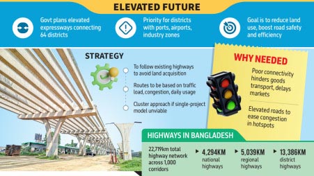
The government is planning a nationwide elevated expressway network to connect all 64 districts, aiming to reduce land use and ensure a safer, advanced transport system.
A project titled “Connecting 64 Districts Through Elevated Highway Network” is in the works, according to senior officials of the Roads and Highways Department.
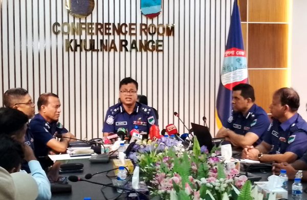
They said a 13-member committee has already been formed to advise on the project’s design, assess costs, and implementation strategy.
The committee is led by Sheikh Moinuddin, special assistant to the chief adviser. It will submit a detailed report to the Ministry of Road Transport and Bridges.
Moinuddin said the proposal is still in its early stages and the committee will soon consult experts and stakeholders to identify the most viable options.
“Where elevated roads are possible, we will build them. Where they are not, we will explore land-use road solutions.
Muhammad Fouzul Kabir Khan, adviser to the road transport ministry, said the aim is to minimise land acquisition by building an elevated road network using existing infrastructure.
He added, “During the Padma Bridge project, hundreds of acres of land had to be acquired beyond the main project. For the Jamuna Bridge, the figure was around 1,600 acres. There are many such instances of unnecessary land acquisition.”
He said the current government will do as much as possible and develop a modular framework that future governments can follow.
MODULAR APPROACH
Officials said the elevated expressway network will follow existing road alignments to avoid land acquisition and will feature multi-tier structures and multimodal transport access.
Routes will be planned based on traffic importance, congestion, and annual average daily traffic. If a single project is not feasible, the network may be implemented through cluster projects by zone.
An official explained that many districts have thriving industries, agricultural production, or tourism potential. However, poor connectivity often delays the transport of goods to markets and ports.
“The goal is to ensure faster movement of people and products, boosting economic activity across regions,” he said, citing the Dhaka-Chattogram highway as an example.
He noted frequent congestion in areas like Signboard, Kanchpur, Burichang, Chandina, and Daudkandi. “Elevated roads could ease pressure in these hotspots without new road expansion.”
He also pointed to the strategic importance of Jashore, which houses an airport, the Benapole land port, a cantonment, and an education board. Similarly, the nearby district of Satkhira also hosts a land port, and Bagerhat is home to the Mongla seaport.
“Elevated expressways will be prioritised in districts with major ports, industries, transport hubs.”
Data from the Roads and Highways Department shows Bangladesh has 22,719km of highways: 4,294km of national highways, 5,039km of regional highways, and 13,386km of district highways – spread across 1,000 major road corridors.
The official said the project committee will assess congestion points and determine where elevated roads are feasible to improve inter-district connectivity. Their report will recommend how many kilometres of elevated road are required and where they should be built.
Md Moniruzzaman, additional chief engineer (Planning and Maintenance Wing) of the Roads and Highways Department, that the expressway network is aimed at ensuring uninterrupted access to major cities and ports, eliminating delays caused by traffic congestion.


Editor & Publisher: Golam Mostafa Jibon
News & Commercial Office:
2 R. K Mission Road, Dhaka & Railgate, Sirajganj.
Hotline: 01715-319996, 01558-314179
E-mail : editor.thedailysky@gmail.com
news.thedailysky@gmail.com