
Will China’s mega dam on the Brahmaputra threaten Bangladesh’s future?
- Update Time : Saturday, August 9, 2025
TDS Desk:
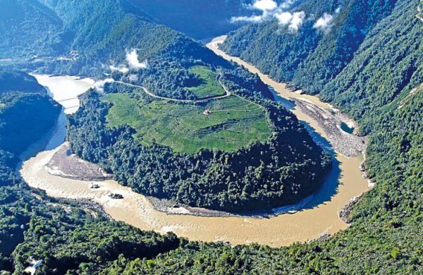
The government of China has formally embarked on constructing what is projected to become the world’s largest hydropower dam on the Yarlung Zangbo River, known downstream as the Brahmaputra in India and Bangladesh. This mega-dam will comprise a cascade of five hydropower stations situated in Nyingchi, southeastern Tibet, and will be capable of generating 60,000 MW of electricity—roughly three times the annual electricity generation of Bangladesh. The groundbreaking ceremony was attended by Premier Li Qiang in July 2025. Once completed in 2033, the project, costing $167 billion, will be the largest hydropower station in the world. The initiative aligns with China’s broader energy ambitions as part of its “West-to-East Electricity Transfer Project”, which aims at achieving carbon neutrality and promoting economic development in Tibet.
Technical feasibility studies for the project have been referenced in Chinese state media and engineering circles, highlighting the unique topographical advantages and engineering challenges. However, detailed feasibility study documents have not been widely circulated internationally or made available in the public domain.
There is no evidence that a comprehensive, project-specific Environmental Impact Assessment (EIA) for this cascade of dams has been publicly released. Historically, for large dam projects in China, EIA documents are seldom disclosed for transboundary river initiatives. Calls for greater transparency and public participation have been voiced both domestically and by international NGOs, but no disclosure had occurred for this project as of July 2025. According to international laws such as the UN Convention on the Non-Navigational Uses of International Watercourses (1997), China cannot unilaterally determine the fate of such a transboundary river that flows through downstream India and Bangladesh. However, none of the co-riparian nations have adopted the 1997 Convention as a mechanism to resolve disputes regarding the sharing of waters in transboundaryrivers. These countries instead maintain bilateral treaties and memoranda of understanding to share flow information. India and Bangladesh share 54 transboundary rivers, but there exists only a non-functional treaty to share lean season flow in the Ganges River.
India and Bangladesh have both raised strong concerns over the potential hydrological, ecological, and strategic impacts on their economies and environments. A 2020 report published by the Lowy Institute, an Australia-based think tank, noted that “control over these rivers effectively gives China a chokehold on India’s economy.” The Chief Minister of India’s Arunachal Pradesh, Pema Khandu, expressed concern that China could even use this as a sort of “water bomb.” These concerns are legitimate. However, the irony lies in the fact that India’s unilateral control of all 54 transboundary rivers shared with downstream Bangladesh has already been acting as a “chokehold” on Bangladesh’s economy and environment—much like what India now fears from China. Moreover, while China’s dams are of the run-of-the-river type, India’s barrages are diversionary in nature and, therefore, far more devastating for Bangladesh. The unilateral diversion of the Ganges River and the Teesta River through the Farakka Barrage and Gajoldoba Barrage, respectively, exemplifies this impact.
What India has been doing to Bangladesh with transboundary rivers does not justify China’s proposed project on the Yarlung Zangbo River. Bangladesh should strongly oppose this project. If necessary, Bangladesh ought to form a partnership with India to raise this concern both with China and at the international level.
India officially protested through diplomatic channels, urging China to ensure that there are no adverse transboundary impacts. India is reportedly planning its own dam in Arunachal Pradesh as a countermeasure. Such a counter-dam will further aggravate water flow issues in downstream Bangladesh. Bangladesh has formally requested more information from China regarding the specifics and downstream effects of the project. Chinese authorities have claimed that the dam will not significantly impact downstream water flow and argue that the primary benefits will be renewable energy supply and local economic growth. They have promised to pay “special attention to ecological preservation”, but have yet to offer detailed mechanisms for official cross-border consultations.
As the most downstream country in the Yarlung Zangbo–Sian–Brahmaputra–Jamuna River watershed, Bangladesh has reason to be concerned about any unilateral control of transboundary rivers by upstream nations, whether India or China. Environmental concerns regarding the construction of large dams on the Yarlung Zangbo River are extensive and multi-layered, encompassing ecological risks, hydrological impacts, economic losses, seismic hazards, and downstream effects on delta-building processes—particularly in the context of sea-level rise caused by climate change.
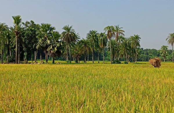
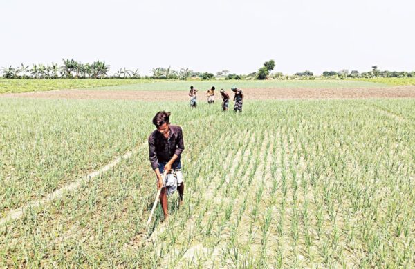
Bangladesh receives about 70% of its lean season flow through the Brahmaputra–Jamuna River system. Any uncertainty or disruption in that flow will have devastating impacts on agriculture, irrigation, fisheries, navigation, and livelihoods. There are also risks of sudden large water releases—whether intentional or accidental—posing serious flood threats to Arunachal Pradesh, Assam, and downstream Bangladesh. Any run-of-the-river hydroelectric project alters the natural flow regime, making downstream flows more erratic and “flashy”, which results in ecological and environmental disruptions. Additionally, even run-of-the-river dams result in a loss of approximately 5% of the flow due to evapotranspiration, seepage, and other factors.
China has already constructed three dams on the upper Brahmaputra (Yarlung Zangbo) River and plans to build several more, including this mega-dam at the Great Bend. Regardless of their design, all these dams—run-of-the-river or not—will inevitably reduce downstream flow.
Large dams typically trap sediments, which can lead to riverbed degradation, loss of soil fertility, collapse of local fisheries, and decline in migratory species such as hilsa and mahseer—species that are critical for regional livelihoods. Additional consequences include the intrusion of saline water in coastal regions of Bangladesh and a decline in sedimentation rates on the coastal plain, which are necessary to offset rising sea levels caused by climate change. A study found that sediment flow in the Mekong River has reduced by about 50%, leading to degraded agriculture and diminished fisheries. A similar reduction in water and sediment flows prevails in the Ganges and Teesta rivers in Bangladesh due to upstream damming. In the 1960s, transboundary rivers carried over 2 billion tonnes of sediments to Bangladesh annually, which has declined to about 1 billion tonnes in recent decades. Dams reduce downstream sediment supply, increasing the erosive power of water and interrupting the natural land-building processes needed to stabilise riverbanks and the delta in Bangladesh. Increased rates of riverbank erosion in recent decades along major rivers in Bangladesh—such as the Brahmaputra–Jamuna, Ganges, Teesta, and Meghna—have been reported by many researchers.
While some Chinese studies suggest dams may stabilise flows by releasing more water in the dry season and holding back floods during the monsoon, Indian officials and hydrologists dispute this, warning that upstream control could worsen floods or create sudden droughts through deliberate or accidental releases, particularly during political tensions or emergencies. The Brahmaputra is a vital source of water for drinking, irrigation, and hydropower for millions in India and Bangladesh. Officials in India’s border state of Arunachal Pradesh have expressed concerns that the Chinese dams could “dry out 80% of the river passing through the Indian state”, thereby threatening regional water supplies and agricultural livelihoods, while also potentially causing massive floods if water is suddenly released. The lack of water-sharing agreements among the co-riparian countries, or transparent data, exacerbates these risks for downstream users.
Despite claims of thorough geological and engineering studies, the absence of published full feasibility reports or Environmental Impact Assessments (EIAs) remains a concern for downstream stakeholders and environmental observers. The dam is located in one of the world’s most seismically active regions, near the site of the devastating magnitude 8.6 Assam–Tibet earthquake of 1950. Experts warn that a strong earthquake or landslide could cause catastrophic dam failures with severe downstream consequences—not only for ecology but also for human settlements and farmland.
In light of the current situation, a proper and technical response by the government of Bangladesh to China’s proposed hydropower station should be multi-layered, assertive, and grounded in international water law and best practices for transboundary river governance. Drawing from expert commentary, global precedents, and Bangladesh’s responses so far, the following ten steps are recommended by this author:
- Reiterate and expand the formal request to China for the release of detailed technical documents, specifically the EIA, Feasibility Study, Climate Impact Assessment, and Disaster Impact Assessment; (b) Actively pursue tripartite engagement—including India, the midstream country—for joint risk assessment and response planning on the Brahmaputra system. However, Bangladesh should forge a partnership with India on the Brahmaputra River issue in exchange for changes in India’s behaviour towards downstream Bangladesh in managing transboundary rivers; (c) Propose or join basin-wide river management initiatives including China, India, Bangladesh, Bhutan, and possibly Nepal, to ensure that all stakeholders’ concerns are addressed before project commissioning; (d) Expedite ratification of the 1997 UN Convention on the Law of the Non-Navigational Uses of International Watercourses to enhance Bangladesh’s standing as the lowest riparian state and to leverage international legal norms for equitable and reasonable use; (e) Explore options for legal arbitration or recourse to international dispute resolution mechanisms if adequate information or mitigation is not assured; (f) Undertake an independent project to study the potential impacts of the dam on Bangladesh, involving both international and local experts; (g) Build alliances with regional and transnational NGOs advocating for equitable and fair transboundary river management; (h) Accelerate internal measures to enhance irrigation efficiency, diversify water sources, and bolster riverine ecosystem resilience to anticipated changes in Brahmaputra flow; (i) Proactively brief media, water experts, and civil society regarding the risks and government actions, thereby increasing international visibility and consensus around Bangladesh’s position; (j) Promote an ecological approach to water resources management at all scales for domestic rivers.


Editor & Publisher: Golam Mostafa Jibon
News & Commercial Office:
Railgate, Sirajganj & 2 R. K Mission Road, Dhaka.
Hotline: 01715-319996, 01558-314179
E-mail : [email protected]